Ghana
| Republic of Ghana | |
|---|---|
 |
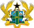 |
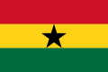
| Flag | Coat of arms |
| Motto | |
| National anthem | "God Bless Our Homeland Ghana" |
| Location | |
.svg) |
|
| Geography | |
| Capital | Accra |
| Largest city | Accra |
| Area | 238.540 km2 |
| Rank | Ranked 78th |
| Water | 3.5 % |
| Bordering countries | Ivory Coast Togo Burkina Faso |
| Time zone | UTC+0 |
| Demographics | |
| Population | 32,340,248 (2,022) inhabitants |
| Rank | Ranked 49th |
| Density | 136 inhabitants/km2 |
| Demonym | Ghanaian |
| Politics and Government | |
| Formation | Independence from the United Kingdom |
| Date | March 6, 1957 |
| Currency | Cedi |
| Telephone dialing code | +233 |
| Edit | see template • edit |

Ghana is a country in west Africa. The capital and largest city is Accra. Other important cities include Kumasi, Tamale, Tema and Sekondi-Takoradi.
It is bordered by Burkina Faso to the north, Togo to the east, the Gulf of Guinea (part of the Atlantic Ocean) to the south, and Côte d'Ivoire to the west.
It gained independence from the United Kingdom in 1960.
The north of Ghana has a dry savanna climate. The south, especially the southwest, has a rainy rainforest climate.
A large part of the country is covered by Lake Volta, a huge man‑made lake where the White Volta and Black Volta rivers meet.
The name Ghana comes from the old Ghana Empire, which was not on the coast but farther inland, in today’s Mali.
History[change | change source]
Many small kingdoms once existed in the area of modern Ghana, such as the Ashanti Empire, the kingdom of the Dagomba, and the Fante federation.
The Portuguese arrived on the coast in the late 15th century (around 1470). In 1482 they built Elmina Castle. Because the area had a lot of gold, Europeans called it the Gold Coast. Later, the English, French and Dutch also built forts there.
The region became an important place in the Atlantic slave trade. Some inland groups sold captured enemies to European traders.
The Dutch took Elmina in 1637 and made the area a Dutch colony. The British arrived in 1672. In 1871 and 1872 the Netherlands gave its remaining forts to the United Kingdom.
After defeating the Ashanti, the British created the colony of the Gold Coast in 1874. After World War I, part of Togo was ruled from Ghana.
A peaceful independence movement grew, and in 1957 the country became independent. The name was changed from Gold Coast to Ghana.
After independence, Ghana had several coups and conflicts. In 1981 Jerry Rawlings took power. In 1992 he allowed free elections, which he won. He left office in 2000 because the constitution did not allow him to continue.
Administrative divisions[change | change source]
Ghana is divided into ten regions:
|
6. Northern |
People[change | change source]
West Africa’s southern coast is one of the most culturally diverse places in the world. All ethnic groups in Ghana belong to the Niger–Congo peoples.
The largest group is the Akan (including the Ashanti), who make up about 41% of the population. Other groups include the Mossi (12%), Ga (8%), Mina (6%), Ewe (4%) and Yoruba (3%).
The main religions are Christianity, Islam and traditional African religions. Each has many followers. Christianity is more common in the south, while Islam is more common in the north.
Ghana has a higher Human Development Index than many African countries. There is no widespread hunger, and many people can read and write.
Gallery[change | change source]
-
 Location of Ghana
 -
 Map of Ghana
References[change | change source]


|
Geography portal — All articles on Geography. |
