|
Vikidia currently has 4,626 articles. Improve it! |
|
Join Vikidia: create your account now and improve it! |
Sylhet city
Sylhet is a city in eastern Bangladesh, on the Surma River. It's known for its Sufi shrines, like the ornate tomb and mosque of 14th-century saint Hazrat Shah Jalal, now a major pilgrimage site near Dargah Gate. The tiny Museum of Rajas contains belongings of the local folk poet Hasan Raja. A triple-domed gateway stands at the 17th-century Shahi Eidgah, a huge open-air hilltop mosque built by Emperor Aurangzeb.
Toponymy[edit | edit source]
Sylhet has been called Srihôṭṭô (in Bangla : শ্রীহট্ট) or Srihatta since ancient times in the Bengali and regional Siloti language. The name Sylhet is an anglicisation of Shilhot (শিলহট). Its origins seem to come from the Sanskrit words of শিলা śilā (meaning stone) and হট্ট haṭṭa (meaning marketplace). These words match the landscape and topography of the hilly region. The shila stones were abundant across Sylhet and King Gour Govinda is known to have used stones to guard his capital. The word changed to Shilhot due to the elision of letter-final অ ô in the Bengali language.
History[edit | edit source]
In 1995, the Government of Bangladesh declared Sylhet as the sixth divisional headquarters of the country. Sylhet has played a vital role in the Bangladeshi economy. Several of Bangladesh's finance ministers have been Members of Parliament from the city of Sylhet. Badar Uddin Ahmed Kamran was a longtime mayor of Sylhet. Humayun Rashid Choudhury, a diplomat from Sylhet, served as President of the UN General Assembly and Speaker of the Bangladesh National Parliament.
In 2001, the municipality was upgraded to the Sylhet City Corporation. It was made a metropolitan city in 2009.
Geography and climate[edit | edit source]

Sylhet is located at 24.8917°N 91.8833°E, in the north eastern region of Bangladesh within the Sylhet Division, within the Sylhet District and Sylhet Sadar Upazila. Sylhet has a typical Bangladesh tropical monsoon climate (Köppen Am) bordering on a humid subtropical climate (Cwa) at higher elevations. The rainy season from April to October is hot and humid with very heavy showers and thunderstorms almost every day, whilst the short dry season from November to February is very warm and fairly clear. Nearly 80% of the annual average rainfall of 4,200 millimetres (170 in) occurs between May and September.
The city is located within the region where there are hills and basins which constitute one of the most distinctive regions in Bangladesh. The physiography of Sylhet consists mainly of hill soils, encompassing a few large depressions known locally as "beels" which can be mainly classified as oxbow lakes, caused by tectonic subsidence primarily during the earthquake of 1762.
Geologically, the region is complex having diverse sacrificial geomorphology; high topography of Plio-Miocene age. Available limestone deposits in different parts of the region suggest that the whole area was under the ocean in the Oligo-Miocene. In the last 150 years three major earthquakes hit the city, at a magnitude of at least 7.5 on the Richter Scale, the last one took place in 1918, although many people are unaware that Sylhet lies on an earthquake prone zone.
Administration[edit | edit source]
Sylhet is divided into 6 metropolitan thanas(police station) and consists of 27 wards and 224 mahallas. The thanas are:
- Bimanbandar Thana
- Kotwali Thana
- Jalalabad Thana
- Dakshin Surma Thana
- Mogla Bazar Thana
- Shah Paran Thana
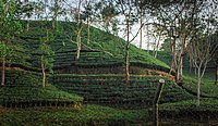
It is a small city with an area of 26.50 km2. The rapid growth and expansion of Sylhet occurred during the colonial period. Sylhet Municipality was established in 1878. A devastating earthquake demolished almost the entire town on 12 June 1897 following which a modern and European model new town was built on the wreckage. Many new roads were constructed in the late 1890s and Sylhet became really connected to the other parts of the country with the establishment of an extension line of Assam Bengal Railway in 1912–15. From the beginning of the 20th century, the importance of Sylhet increased with the establishment of the tea industry. In the 1950s and 1960s, rapid urbanisation took place in the town, fostered by the expatriate Sylhetis and the process is still ongoing.
On 10 April 2001, Sylhet was changed to a city corporation from a municipal board, and currently the city is administrated by the Sylhet City Corporation. At present, Sylhet is the district-headquarters as well as the divisional headquarters of the districts of Sunamganj, Habiganj, Moulvibazar and Sylhet District. The Sylhet City Corporation is responsible for the services that are provided within the city which includes traffic, roads, garbage collection, water supply, registrations and many others. The corporation consists of the mayor and 22 other commissioners, and focuses on the development of the city.
Twinned administrative body[edit | edit source]
International relations[edit | edit source]

Sylhet, nestled in the picturesque landscapes of northeastern Bangladesh, stands as a pivotal center for international relations, marked by its strategic collaborations and diplomatic engagements. Notably, the presence of the Qatar Visa Center and the British Consular Office underscores the city's global significance. The Qatar Visa Center in Sylhet serves as a key facilitator for individuals seeking travel and employment opportunities in Qatar, contributing to the city's role as a gateway for international mobility. Simultaneously, the British Consular Office reflects the enduring ties between Sylhet and the United Kingdom, offering consular services and support to residents and travelers. These diplomatic establishments highlight Sylhet's importance as a hub for consular affairs, symbolizing its integral role in Bangladesh's international landscape. The city's ability to host such crucial diplomatic offices further cements its status as a focal point for global interactions and collaborations.
See also[edit | edit source]
External link[edit | edit source]
References[edit | edit source]
- ↑ Q466221. (2023, December 20). Wikidata. Retrieved 06:04, December 22, 2023 from https://www.wikidata.org/w/index.php?title=Q466221&oldid=2033092831.

