|
Vikidia currently has 4,626 articles. Improve it! |
|
Join Vikidia: create your account now and improve it! |
File:Map of Great Plains2.jpg
Jump to navigation
Jump to search

Size of this preview: 800 × 493 pixels. Other resolutions: 320 × 197 pixels | 640 × 394 pixels | 960 × 591 pixels.
Original file (960 × 591 pixels, file size: 48 KB, MIME type: image/jpeg)

|
This locator map image could be re-created using vector graphics as an SVG file. This has several advantages; see Commons:Media for cleanup for more information. If an SVG form of this image is available, please upload it and afterwards replace this template with
{{vector version available|new image name}}.
It is recommended to name the SVG file “Map of Great Plains2.svg”—then the template Vector version available (or Vva) does not need the new image name parameter. |


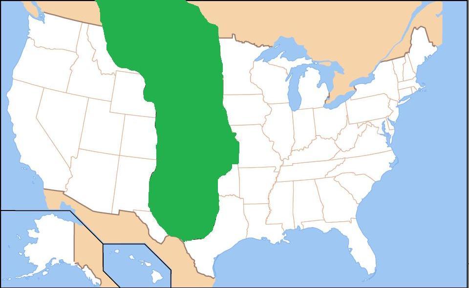
| Description | Map of the Great Plains (shaded in green). | ||
| Date | |||
| Source | Own work (Original text: own work, based on image from Center for Great Plains Research at Univ. of Nebraska-Lincoln) | ||
| Author | Before My Ken | ||
| Permission (Reusing this file) |
|
File history
Click on a date/time to view the file as it appeared at that time.
| Date/Time | Thumbnail | Dimensions | User | Comment | |
|---|---|---|---|---|---|
| current | 12:47, 4 April 2009 | | 960 × 591 (48 KB) | wikimediacommons>Before My Ken | slight cleanup |
File usage
The following page uses this file: