|
Vikidia currently has 4,626 articles. Improve it! |
|
Join Vikidia: create your account now and improve it! |
File:ষাট গম্বুজ মসজিদ, বাগেরহাটের সম্মুখ দৃশ্য.jpg
Jump to navigation
Jump to search


Size of this preview: 800 × 533 pixels. Other resolutions: 320 × 213 pixels | 640 × 427 pixels | 1,024 × 683 pixels | 1,280 × 853 pixels | 2,560 × 1,706 pixels | 4,022 × 2,681 pixels.
Original file (4,022 × 2,681 pixels, file size: 4.85 MB, MIME type: image/jpeg)
Summary
| Description |
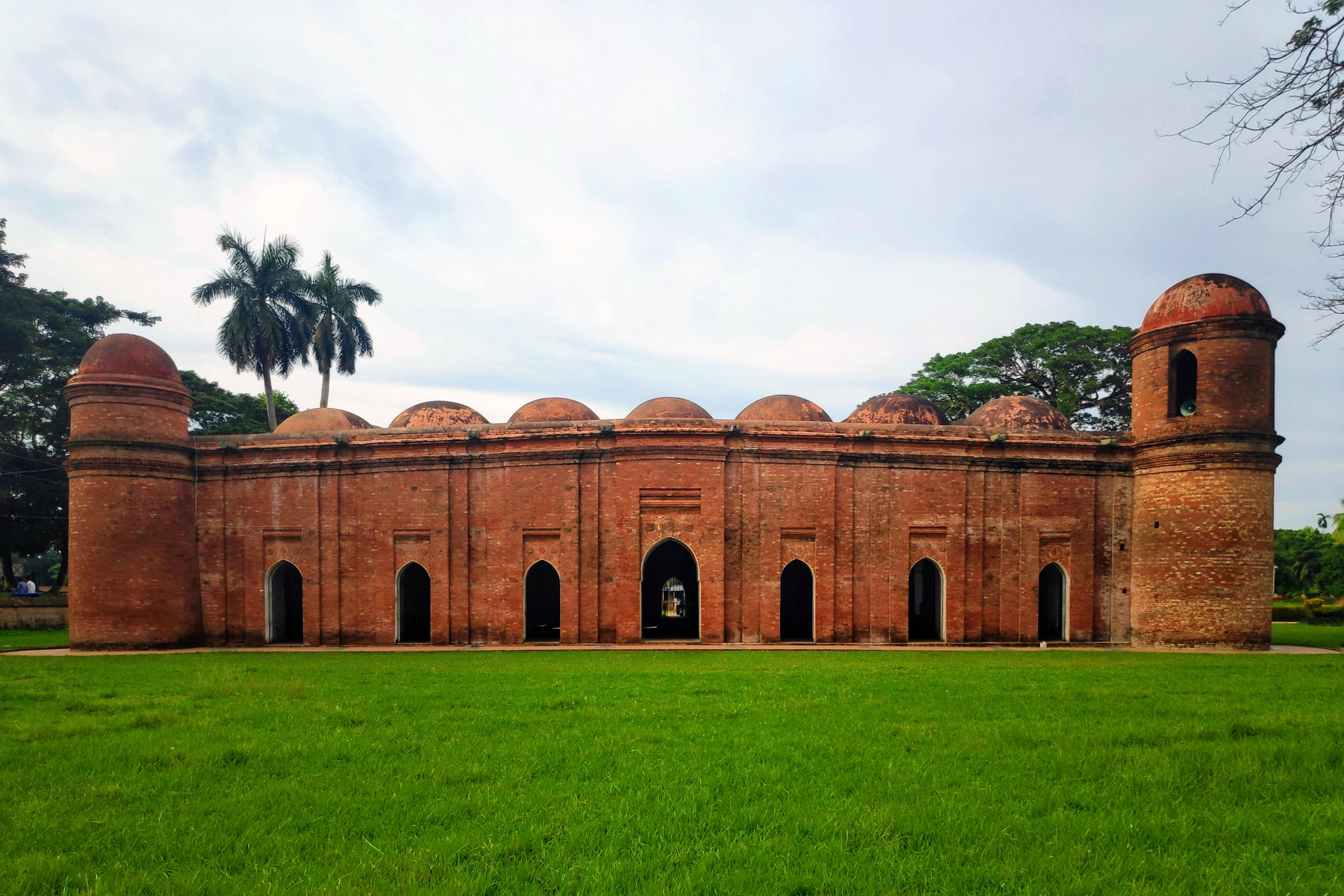
English: The Sixty Dome mosque, also known as the Shait Gambuj Mosque or Saith Gunbad Masjid, is a mosque in Bagerhat, Bangladesh. It is part of the Mosque City of Bagerhat, a UNESCO World Heritage Site. It is the largest mosque in Bangladesh from the sultanate period (1204-1576). It was built during the Bengal Sultanate by Ulugh Khan Jahan, the governor of the Sundarbans.
|
||
| Date | |||
| Source | Own work | ||
| Author | Faisal Photography |
| Camera location | | View this and other nearby images on: OpenStreetMap |
|---|
Licensing
I, the copyright holder of this work, hereby publish it under the following license:
This file is licensed under the Creative Commons Attribution-Share Alike 4.0 International license.
- You are free:
- to share – to copy, distribute and transmit the work
- to remix – to adapt the work
- Under the following conditions:
- attribution – You must give appropriate credit, provide a link to the license, and indicate if changes were made. You may do so in any reasonable manner, but not in any way that suggests the licensor endorses you or your use.
- share alike – If you remix, transform, or build upon the material, you must distribute your contributions under the same or compatible license as the original.

|
This image was uploaded as part of Wiki Loves Monuments 2022.
|
 |
File history
Click on a date/time to view the file as it appeared at that time.
| Date/Time | Thumbnail | Dimensions | User | Comment | |
|---|---|---|---|---|---|
| current | 21:54, 27 October 2022 | | 4,022 × 2,681 (4.85 MB) | wikimediacommons>Faisallutpat2 | Uploaded own work with UploadWizard |
File usage
The following page uses this file: