|
Vikidia currently has 4,621 articles. Improve it! |
|
Join Vikidia: create your account now and improve it! |
File:Map of North Dakota NA.png
Jump to navigation
Jump to search

Size of this preview: 776 × 600 pixels. Other resolutions: 311 × 240 pixels | 621 × 480 pixels | 994 × 768 pixels | 1,280 × 989 pixels | 2,122 × 1,640 pixels.
Original file (2,122 × 1,640 pixels, file size: 1.75 MB, MIME type: image/png)
Summary
| Description |
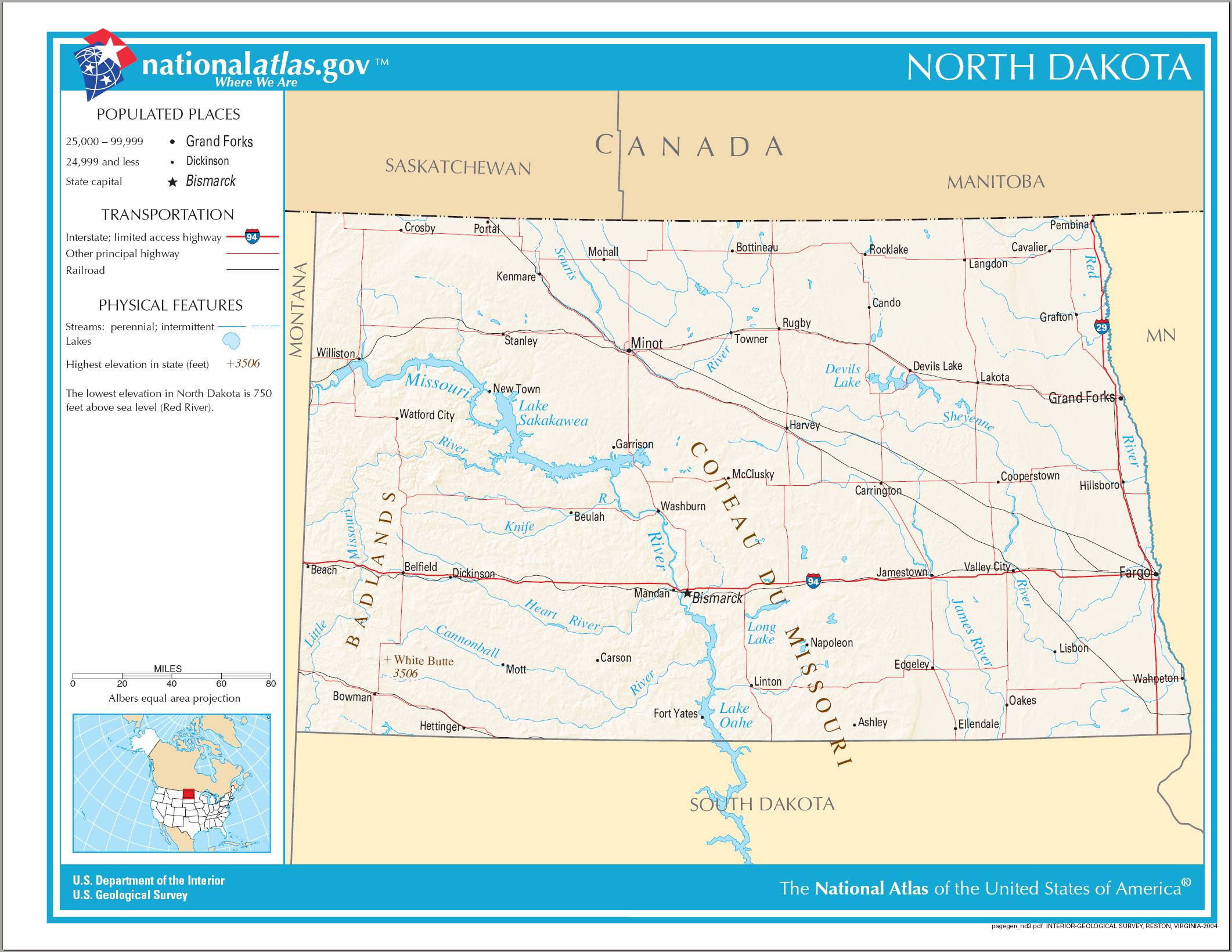
English: Map of North Dakota. |
| Date | |
| Source | National Atlas |
| Author |
Licensing
This map was obtained from an edition of the National Atlas of the United States. Like almost all works of the U.S. federal government, works from the National Atlas are in the public domain in the United States.
Online access: NationalAtlas.gov | 1970 print edition: Library of Congress, Perry-Castañeda Library
|
File history
Click on a date/time to view the file as it appeared at that time.
| Date/Time | Thumbnail | Dimensions | User | Comment | |
|---|---|---|---|---|---|
| current | 23:40, 14 August 2006 | | 2,122 × 1,640 (1.75 MB) | wikimediacommons>Huebi~commonswiki | {{Information| |Description=Map of North Dakota |Source=[http://www.nationalatlas.gov National Atlas] }} Category:Maps of the United States Category:Maps of North Dakota {{PD-USGov-Atlas}} |
File usage
The following page uses this file: