|
Vikidia currently has 4,625 articles. Improve it! |
|
Join Vikidia: create your account now and improve it! |
File:MacedonEmpire.jpg
Jump to navigation
Jump to search


Size of this preview: 800 × 382 pixels. Other resolutions: 320 × 153 pixels | 640 × 306 pixels | 1,024 × 489 pixels | 1,990 × 951 pixels.
Original file (1,990 × 951 pixels, file size: 1.86 MB, MIME type: image/jpeg)
| Description |
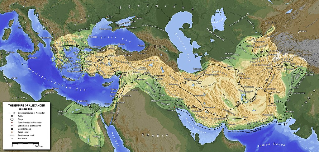
English: Extent of the empire of Alexander the Great
Ελληνικά: Έκταση αυτοκρατορίας Μεγάλου Αλεξάνδρου
Español: Extensión del imperio de Alejandro Magno
Français : Etendue de l'empire d'Alexandre le Grand
Հայերեն: Ալեքսանդր Մակեդոնացու կայսրության քարտեզը
Македонски: Карта на древното Македонско Царство
Polski: Mapa Imperium Aleksandra Macedońskiego
Русский: Карта империи Александра Македонского
Türkçe: Büyük İskender'in genişlettiği imparatorluğu |
||||||||||
| Date | |||||||||||
| Source | Own work | ||||||||||
| Author | Generic Mapping Tools | ||||||||||
| Permission (Reusing this file) |
|
||||||||||
| Other versions |
Derivative works of this file:
|


File history
Click on a date/time to view the file as it appeared at that time.
| Date/Time | Thumbnail | Dimensions | User | Comment | |
|---|---|---|---|---|---|
| current | 18:26, 8 September 2020 | | 1,990 × 951 (1.86 MB) | wikimediacommons>Claude Zygiel | Shorelines of the hellenistic times |
File usage
The following page uses this file: