This file is from Wikimedia Commons and may be used by other projects.
The description on its file description page there is shown below.
Summary
DescriptionKarte Cook Seereise nr1.png
Deutsch:
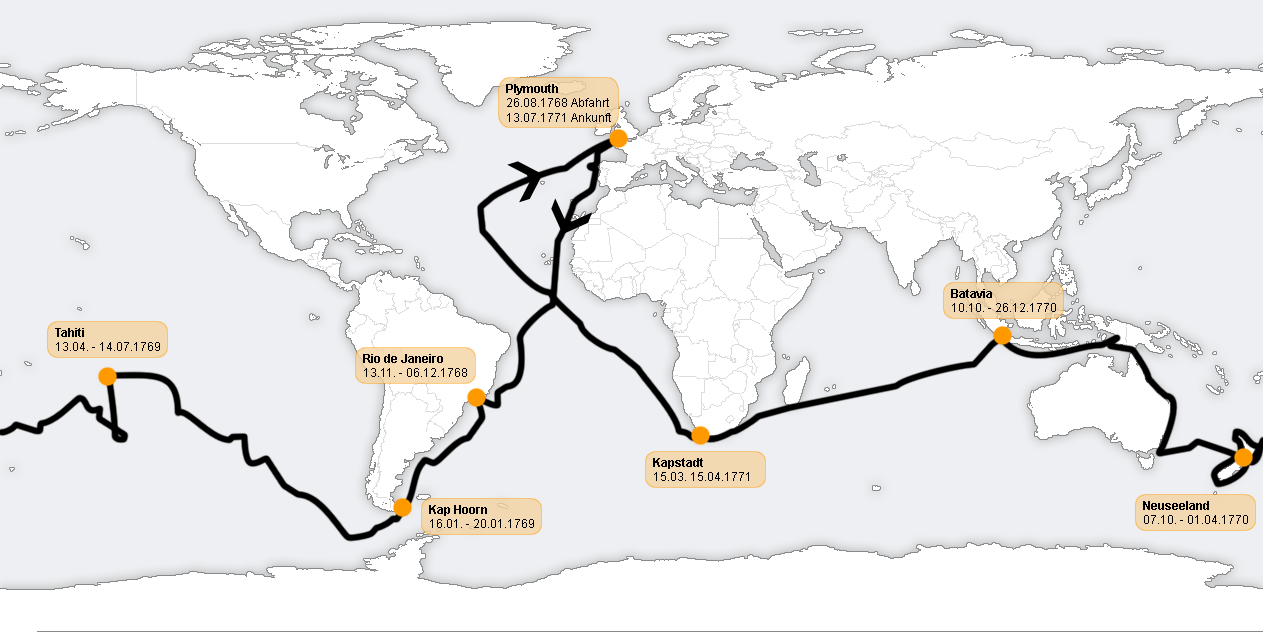
Beschreibung: Verlauf der ersten Südseereise von James Cook, 1768 - 1771. Den Verlauf konnte ich nicht bis ins letzte Detail übernehmen.
English: The Route of Captain James Cook's first voyage, 1768 -1771. Map labelled in German, so Cape town written as Kapstadt and New Zealand as Neuseeland using current German spelling. Abfahrt is departure, ankunft is arrival.
to share – to copy, distribute and transmit the work
to remix – to adapt the work
Under the following conditions:
attribution – You must give appropriate credit, provide a link to the license, and indicate if changes were made. You may do so in any reasonable manner, but not in any way that suggests the licensor endorses you or your use.
share alike – If you remix, transform, or build upon the material, you must distribute your contributions under the same or compatible license as the original.
The original description page was here. All following user names refer to de.wikipedia.
2005-09-24 13:13 C.lingg 1263×632×8 (98819 bytes) * Beschreibung: Verlauf der ersten Südseereise von James Cook, 1768 - 1771. * Quelle: selbst gezeichnet, [[http://www.demis.nl/home/pages/wms/demiswms.htm Weltkarte]], [[http://southseas.nla.gov.au/journals/maps/01_world.html Verlauf]]. Überarbeitet und
2005-09-02 19:48 C.lingg 1227×613×8 (268796 bytes) *Beschreibung: Verlauf der ersten Südseereise von James Cook, 1768 - 1771. Den Verlauf konnte ich nicht bis ins letzte Detail übernehmen. *Quelle: selbst gezeichnet, Weltkarte entnommen von http://www.demis.nl/home/pages/wms/demiswms.htm, der Verlauf wu
Captions
Verlauf der ersten Südseereise von James Cook, 1768 - 1771
{{Information |Description= *Beschreibung: Verlauf der ersten Südseereise von James Cook, 1768 - 1771. Den Verlauf konnte ich nicht bis ins letzte Detail übernehmen. *Quelle: selbst gezeichnet, Weltkarte entnommen von http://www.demis.nl/home/pages/wms/


